Splendid views and contact with nature, clusters of rustic stone houses and ruins of old mills, castles and fortifications, chapels and churches, terraces of vines and olive trees, an extraordinary combination of human activity and nature, art and culture, as well as excellent state of preservation and maintenance have led to the recognition of this path by the Italian Touring Club as the first path certified by the organization.
- A full immersion in art and nature -
Wayfarer’s Path
The Sentiero del Viandante (Wayfarer's Path) is a hillside route that runs along the eastern shore of Lake Como, joining Lecco and Colico, touching all the towns on the Riviera.
It then continues towards Valtellina thanks to a network of paths. The entire route, marked by the typical orange arrows, measures 45 km and can be covered in full or in stages, thanks to the presence of railway stations in each municipality or the moorings of the Lario boats and hydrofoils.
The Sentiero del Viandante (Wayfarer’s Path) does not follow an ancient route, but is the result of the union of a number of paths which in ancient times joined together the towns on the Lecco side of the lake and which in turn were part of a wider system of roads linking Milan to the Alpine passes. Its origin is uncertain, but some studies would date it back to Roman times; what is certain, however, is that it was one of the two routes for the transport of goods and people: the second after the lake itself. Although travel by land was more uncomfortable and less secure, the path also had the purpose of connecting the various fortifications dotted around the territory, constituting a real defensive system.
From the middle of the nineteenth century it was abandoned following the construction of the tunnels of the Spluga Road, today the Lake Como Provincial Road, which greatly improved transport.

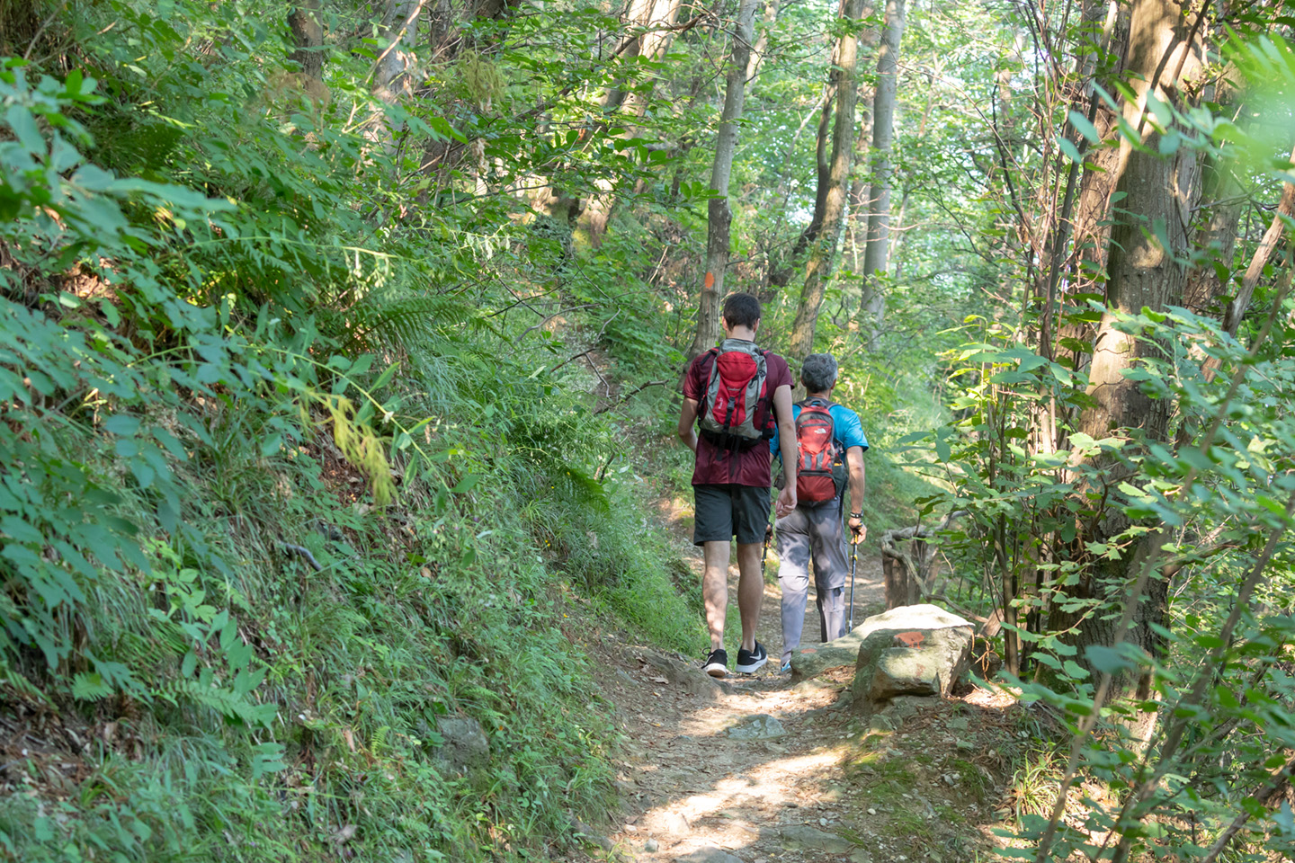
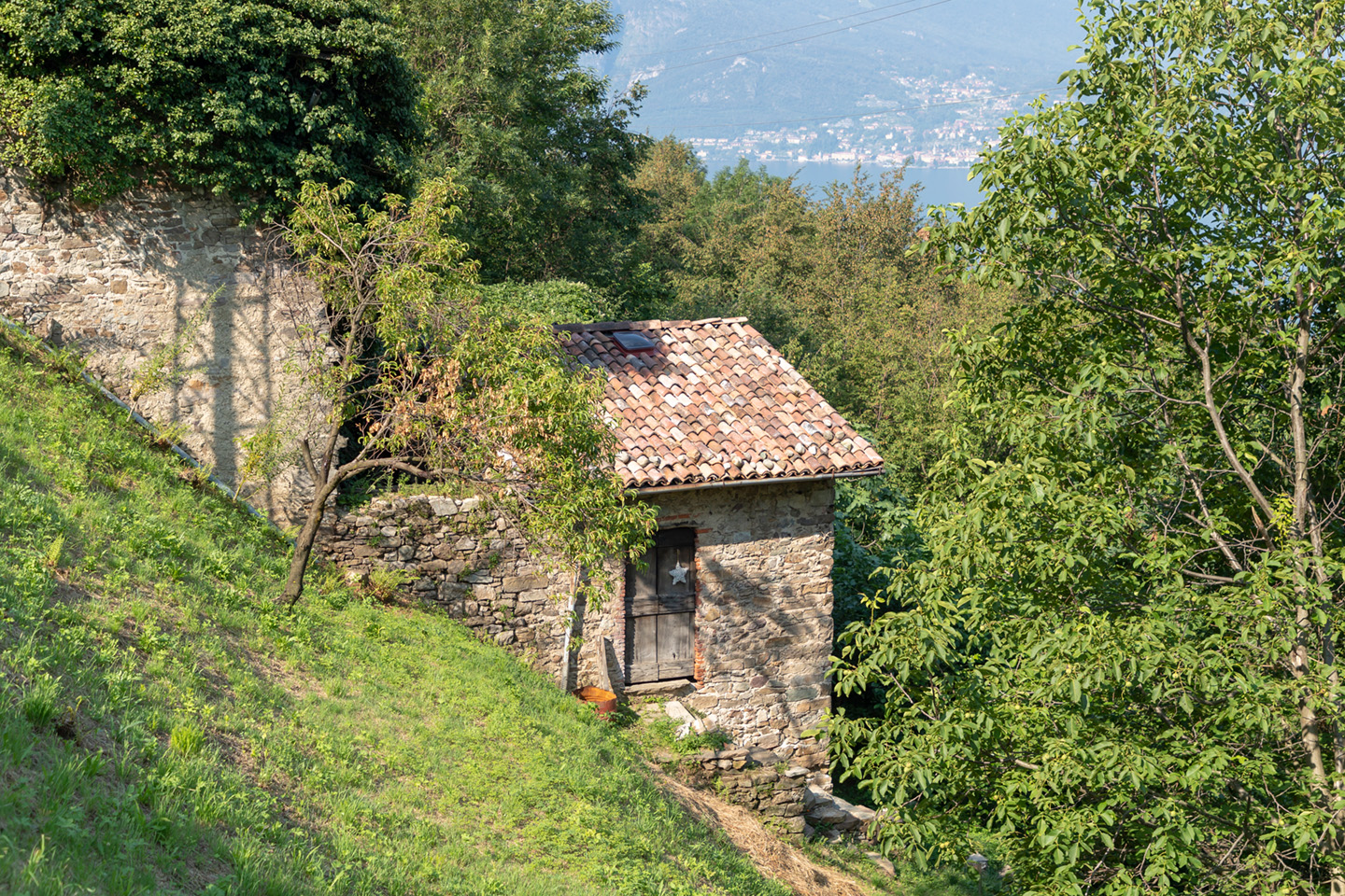
Trail near Biosio
The name “Sentiero del Viandante” (Wayfarer’s Path) is a recent invention and can be traced back to 1992, when the recovery and restoration of the various sections of the path was completed by the Lecco tourist board.
In the past, instead, the communication road of the eastern bank was known as “via Ducale” or “via Regia”; in recent times, finally, some stretches were named “Napoleona” due to the renovations carried out during the Napoleonic age.
The route starts from the small church of San Martino in the municipality of Abbadia Lariana, although the section from Lecco will soon be restored. After passing the towns of Mandello del Lario and Lierna and arriving near the cemetery in Varenna, the original route climbs towards the Val d’Esino: a gorge crossed by the stream of the same name and dominated by Mount San Defendente. A steep climb leads to the small and characteristic village of Vezio, in the municipality of Perledo, where a visit to its famous castle is a must. Continuing to climb through the woods and past Mount Fopp, you reach the village of Ortanella: a small hamlet immersed in the green of the mountains in the municipality of Esino Lario. Following the vehicle road through the meadows of Ortanella you arrive at the center of the village, known by the pseudonym of “pearl of the Grigne”.
The original route is now flanked by a less strenuous variant that runs along the lake: once you reach the village of Vezio you can cross part of the municipality of Perledo and its characteristic hamlets: Regolo, Gittana and Cestaglia, and then continue until you reach the municipality of Bellano. From the square of Vezio you descend towards the River Esino, which is crossed by the characteristic stone bridge and, leaving the old mill on the right, you go up towards the industrial area of Campallo. From here, taking the road for Regolo, you will come across a small church belonging to the list of Marian Sanctuaries and once you have arrived in the center of the hamlet, continue along the road that leads to the hamlet of Gittana. When you reach the Maglia chapel, take the paved road again and descend onto a mule track and, leaving the splendid parish church on the right, cross the historic center of Gittana. Climb once more, crossing a small wooden bridge over the Masna stream and, having passed the hamlet of Cestaglia, gradually go back down towards Bellano.
The path also had the purpose of connecting the various fortifications dotted around the territory, constituting a real defensive system.

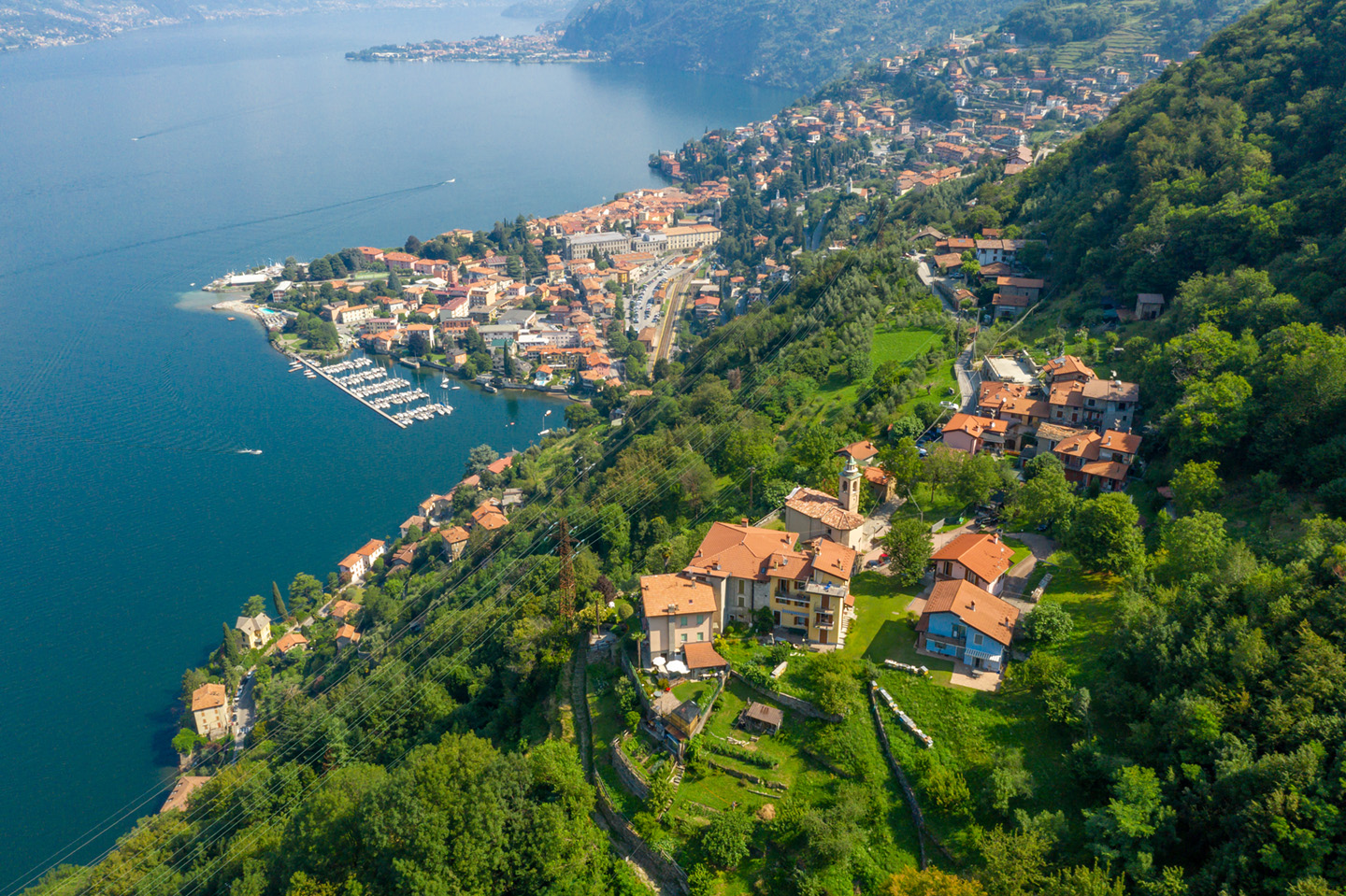
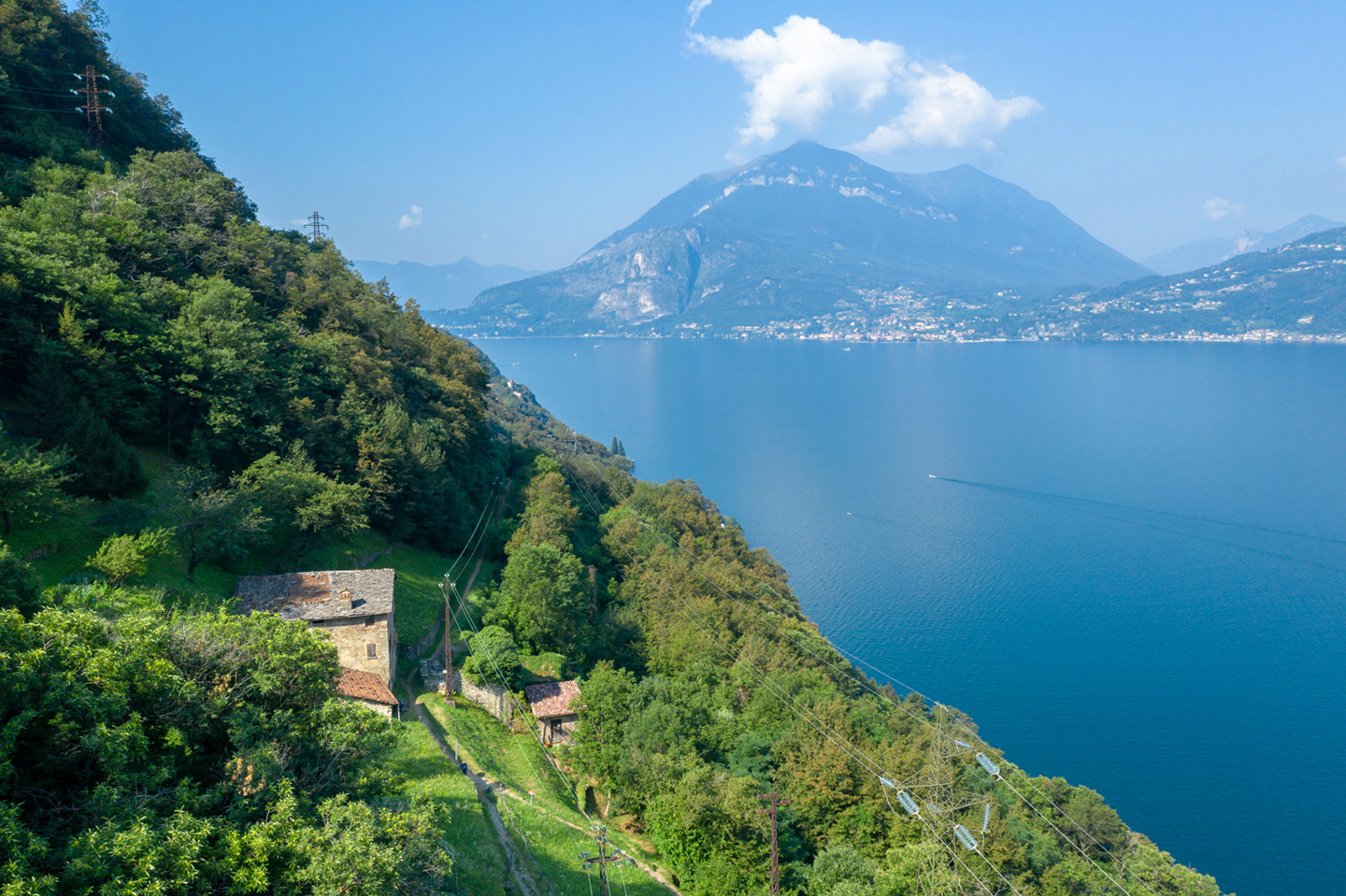
Eastern shore of Lake Como
After crossing the small bridge over the little valley of Biosio you go down towards the mouth of the Pioverna where Bellano lies; after the small chapel of the Madonna Addolorata in Rivalba you continue until you cross the Roman bridge over the Orrido di Bellano and you reach the portico of the church of Santi Rocco e Sebastiano al Ponte. From here it is possible to go down towards the village along the prepositural church of the Saints Nazzaro and Celso and the entrance of the Orrido, or continue the walk by climbing again thanks to a steep mule-track that goes along the splendid monumental cemetery and continues up to the hamlet of Ombriaco. After passing the church of San Bernardino we head towards the Sanctuary of Lezzeno from whose panoramic terrace we can admire a splendid view of the center and upper lake. From here you begin the descent through the woods towards the hamlets of Pendaglio and Oro to take the dirt road that leads to the hamlet of Verginate from where you can admire enchanting sunsets over the lake.
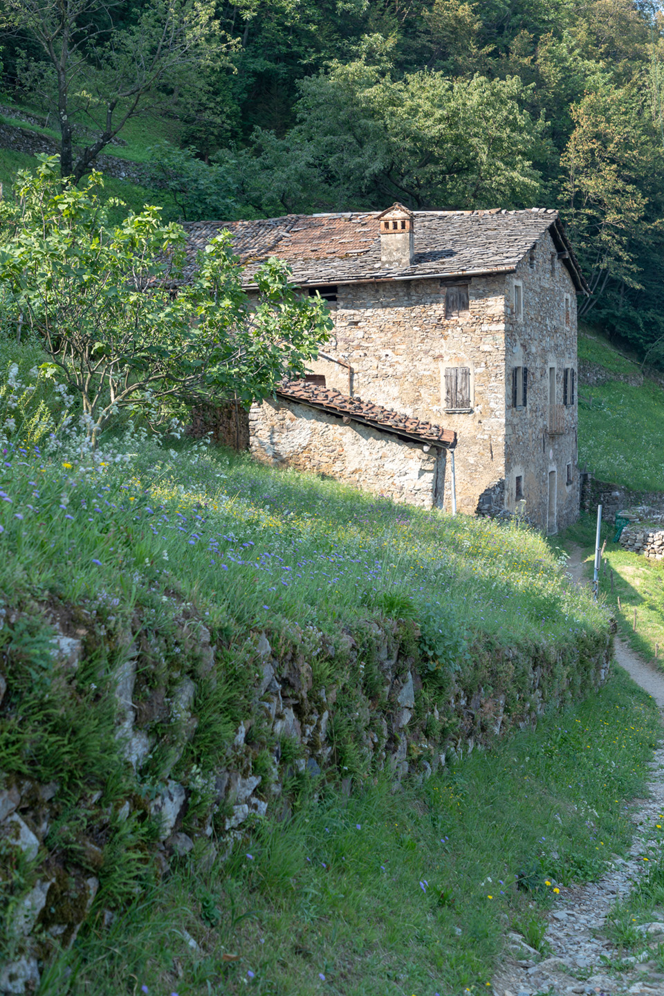
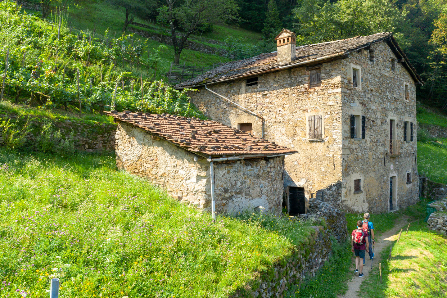
The mule track continues past the bridge over the Val Grande, reaching first the houses of the Ronchi and then the Chignolo farmsteads in the municipality of Dervio. Just above the railway line, the old Nazionale road leads to Villa di Dervio, reaching the ancient church of San Quirico with its beautiful Romanesque bell tower, and then crosses the river Varrone on the bridge that was its stronghold until 1389. Turn right to reach the Lavine spring on the carriage road that leads to Valvarrone, and then take a steep, stepped mule track that leads to the village of Castello with its medieval tower and the small church of San Leonardo. Leaving the town center, take the provincial road down to the roundabout and continue straight ahead on the road that leads to Corenno Plinio: the itinerary passes through the villages of Chiari and Monastero where you will find the rustic complex that made up the Monastery of San Clemente degli Umiliati. Once past a culvert, the route resumes the ancient conformation of a cobbled mule track that descends between low walls with a wide and stupendous view of the medieval village of Corenno Plinio with its majestic castle and the church of St. Thomas of Canterbury.

The itinerary continues first along the provincial road, then takes the mule track on the right that crosses meadows and farmsteads to reach the territory of Dorio. You will then encounter a slight slope as far as Torchiedo and Panico where you can admire the Church of San Giorgio, the old parish church of Dorio. The route climbs again towards Mandonìco: a characteristic group of abandoned houses made of rough local stone. The mule track then cuts across the coast to reach the small church of San Rocco, located on a headland with a panoramic view of the lake and the peninsula of Piona. The path bends to the north-east in view of the small lake named Abbazia di Piona, going around the buttresses of Legnoncino. Through the woods you reach Monte Perdonasco and, passing through the Val di Noh, you arrive at Monte Sparesee. From here an unpaved stretch in woodland reaches a cartroad that descends with rapid bends to Posallo di Colico. It continues on to Piantedo where the original route ends near the Sanctuary of the Madonna di Val Pozzo.

Top view
Galleria fotografica